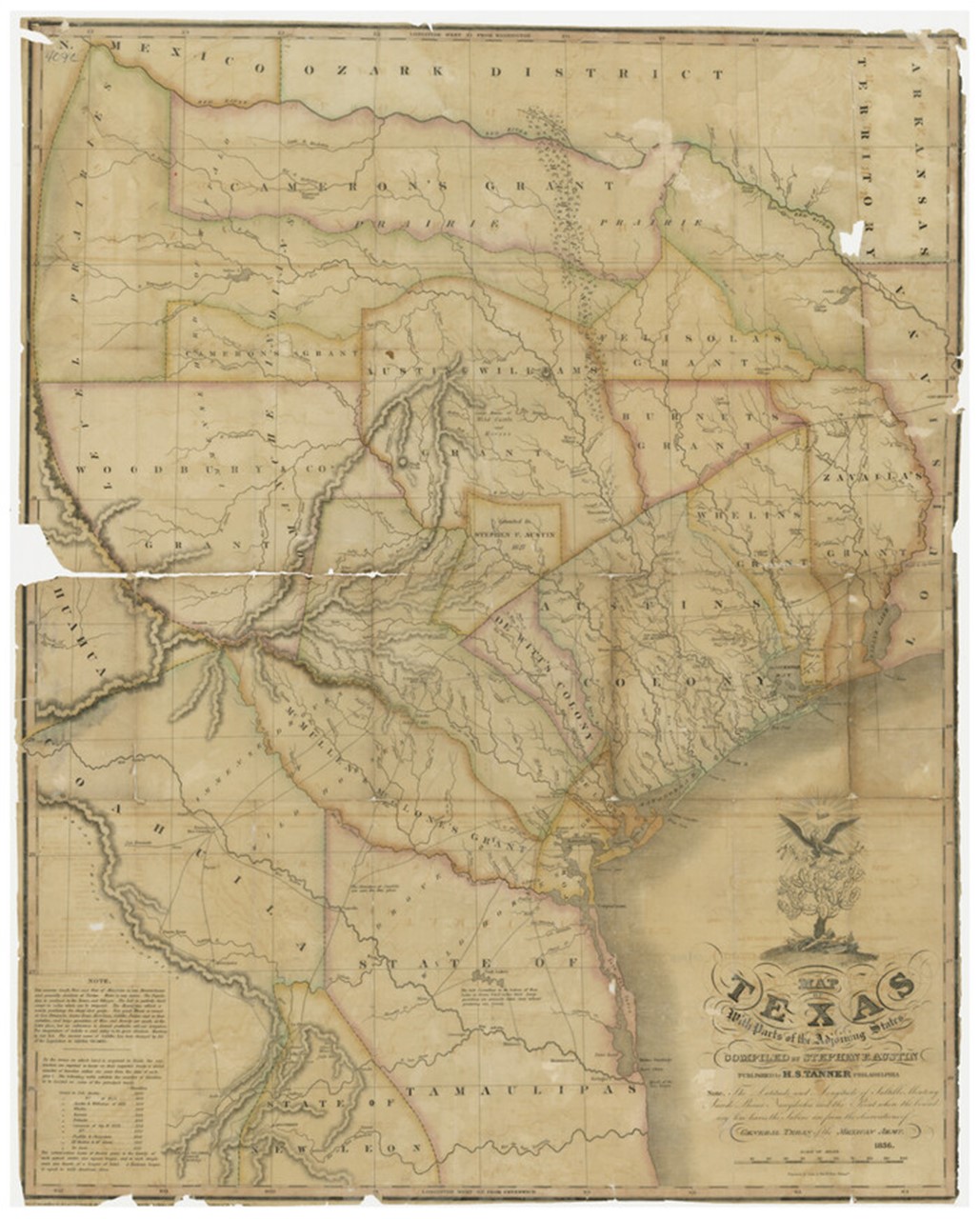

Listen in for an exciting adventure as we explore the geography of Texas in the 1820s and 30s through an 1836 map of Texas drawn by Stephen F. Austin and published in Philadelphia by the renowned map maker H.S. Tanner. Interestingly, this map was not the first edition but a revised version with subtle differences from the original, published in 1829.
The first edition of the map proved so popular it quickly sold out, and Tanner published the map from new plates every year between 1829 and 1836. This gives us a unique window into the rapidly changing landscapes of 1830s Texas.
Grab your earphones and join John Warr, the map's engraver, as he traces the shifting lines of Texas between 1828 and 1836. We invite you to join us on this journey through time and history as we discover the significance of this map and its importance in understanding the early American settlement in Texas. Settle in to enjoy our first episode, "The Map is the Thing!"
The copy of the 1836 Tanner Map of Texas held by the Star of the Republic Museum has not been digitized; however, a sister copy held by the Texas General Land Office has. Click here to explore their high-resolution version.
Learn More:
- Maps of an Empresario: Contributions to the Cartography of Texas, Robert S. Martin
- Notes and Documents: Austin-Leaming Correspondence, 1828-1836, Ed. Andreas Reichstein
- Book: Stephen F. Austin: Empresario of Texas, Gregg Cantrell
- Book: The Life of Stephen F. Austin, Eugene Barker